Observe the Weather in a More Intuitive Way
Visible satellite imagery allows us to observe the atmosphere in the most intuitive way, which is crucial for monitoring of various meteorological phenomena such as tropical cyclones, severe convection and haze, but is unavailable at night.
Thus, we present a conditional generative adversarial networks model1 to generate nighttime VIS imagery with significantly enhanced accuracy, and can simulate sunlight directions at any time of day2. It significantly contributes to nighttime monitoring and allows meteorologists to observe global atmospheric changes 24 hours a day3.
Our model achieved outstanding results in all metrics compared to pre-existing models. Check out our paper
Achieve All-Day Observation
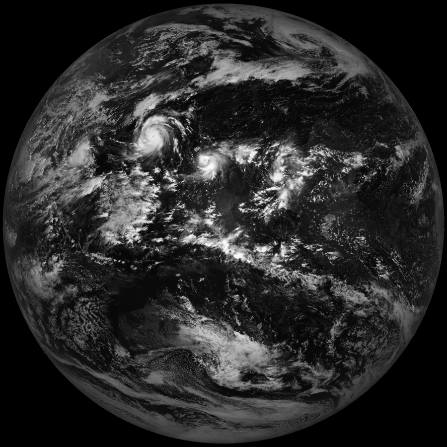
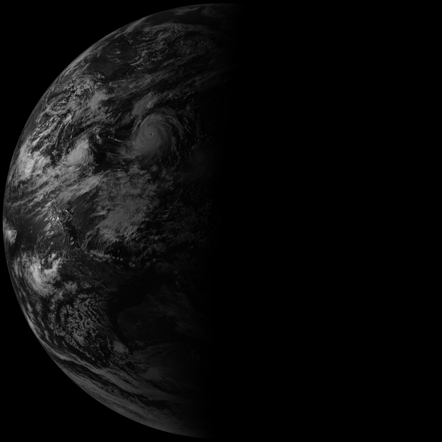
AI-VIS provides simulated visible imagery at any time. The left panel displays a pair of visible (VIS) and AI-VIS full-disk imagery at 16:30 BJT. In addition, AI-VIS can simulate sunlight directions at any time of day. The right panel shows the AI-VIS imagery of Typhoon Bolaven (2023) simulated for different sunlight directions.
We provide AI-VIS products for three different areas of observation: Mesoscale, Floater, and ROI-Floater. Mesoscale imagery offers high-frequency monitoring over an area ~1,000 km across, typically targeting tropical cyclones or thunderstorms; Floater imagery is centred on any active tropical cyclone or investigative area; ROI-Floater imagery covers the coastal region of China, supporting coastal weather monitoring such as fog detection. Mesoscale and ROI-Floater imagery uses the fixed sunlight direction at 9 a.m. local time, and Floater imagery uses the actual sunlight direction during the day and uses the sunlight direction 12 hours earlier during the night.
Make Cyclone tracking More Accurate
Easily Locate Tropical Cyclones
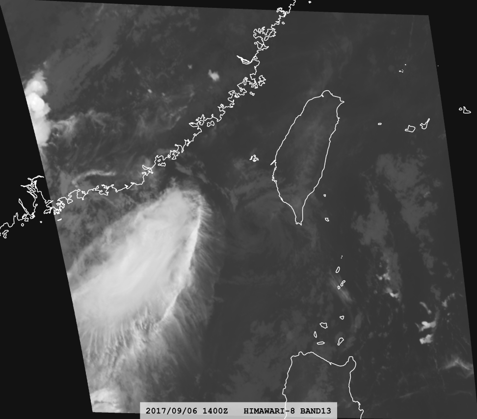
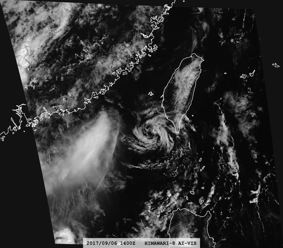
As confirmed by ASCAT wind data, AI-VIS enables us to intuitively view the location of the low-level circulation center of the tropical cyclone. Whereas ASCAT wind data is available only once or twice a day, AI-VIS provides continuous monitoring of the tropical cyclone center.
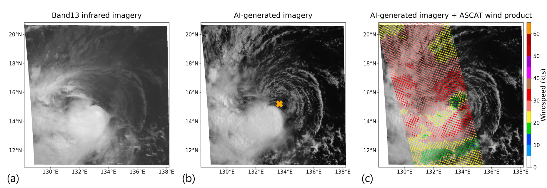
Better Identification of the "Eye Zone"
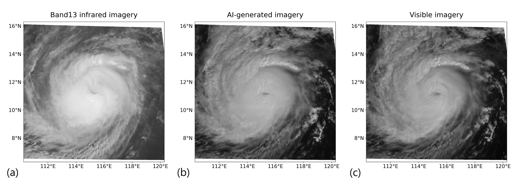
When a tropical cyclone intensifies beyond a certain threshold, a roughly circular core tens of kilometres across forms in which wind speeds drop sharply, rainfall ceases, and mostly clear skies reveal sunlight by day and stars by night - this is called the cyclone's eye. The emergence of this eye is known as eye formation. In the early stage of eye formation, dense cirrus clouds often cover the nascent eye, so thermal-infrared imagery cannot delineate the eye accurately, hampering precise storm positioning and intensity estimation. AI-VIS overcomes this limitation by delivering imagery that mirrors daytime visible-light observations, enabling reliable identification of the eye even under heavy cirrus cover.
Make Cyclones Without Convective Clouds "Appear"
When a developing tropical cyclone is subjected to strong vertical wind shear, deep convection becomes decoupled from the low-level circulation and the storm's intensity steadily diminishes. Once the convection is completely displaced, thermal-infrared imagery can no longer identify the circulation center with confidence, hampering accurate fixes of position and strength. AI-VIS imagery, however, depicts the line-shaped low-level cumulus clouds as crisply as standard visible imagery, so the low-level center stands out at a glance.
Make Fog Detection More Effective
Fog is difficult to detect with infrared bands at night, but our AI-VIS can cleverly distinguish the difference between fog and cold airmasses through deep-learning technology, thereby achieving direct observation at night, allowing meteorologists to more easily and accurately identify the scope of fog areas and provide more accurate visibility forecasts.
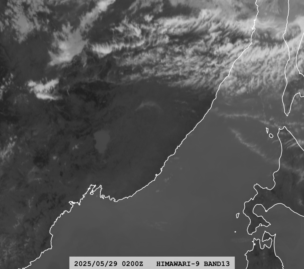
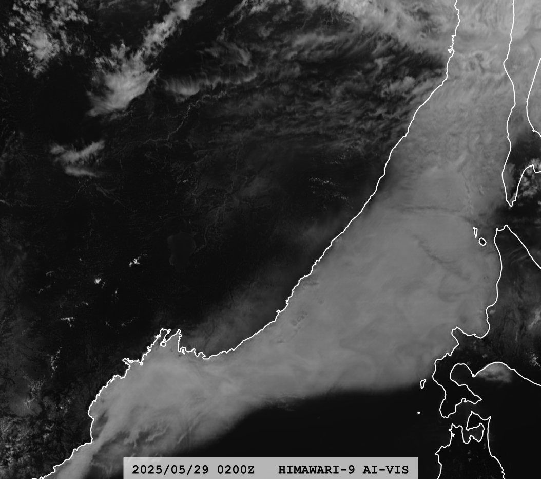
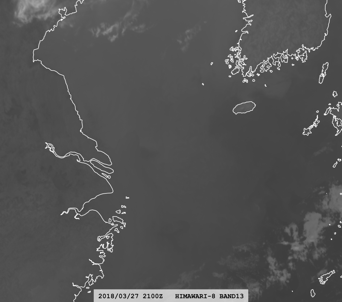
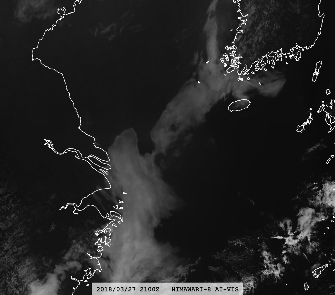
Image Types
We provide the following types of AI-VIS images. Each type has unique strengths and is optimized for specific conditions.
AI-VIS
Baseline output of our CGAN model in 2 km resolution at nadir.
AI-EVIS
Enhanced the contrast of clouds for high-reflectance scenes; best around local noon.
AI-VIS-ENH
Rescaled reflectance to match human visual perception; suited for medium and low reflectance.
AI-VIS-SR*
Processed by our super-resolution network specifically trained on a VIS dataset; provides image resolution close to AHI Band 03 (0.5 km at nadir).
AI-EVIS-SR*
Super-resolution counterpart of AI-EVIS.
AI-VIS-ENH-SR*
Super-resolution counterpart of AI-VIS-ENH.
Our Released Models*
| Model Name | Model Params** | Finish Time | Model Weights |
|---|---|---|---|
| AI-VIS 1.0 | 67M | 2024/3 | HuggingFace🤗 |
| AI-VIS 1.5-Small | 67M | 2024/9 | Request Form*** |
| AI-VIS 1.5-Large | 263M | 2024/12 | Request Form*** |
** Params are counting the generator only, as only the generator is used during inference, and the discriminator is very small compared to the generator.
*** If you're unable to access Google Forms, please email wang3399@wisc.edu.
2. We used the method of inputting the hour angle to control the angle of the sunlight.
3. It depends on whether the data source can provide reliable data for all-day. The current data source of the AI-VIS service page is NOAA and Amazon.
Copyright © 2020- Dapiya Team. All Rights Reserved.
Contact: dapiya-team@outlook.com